Catalina Swim Adventures
Get on the list

Map

Where we swim

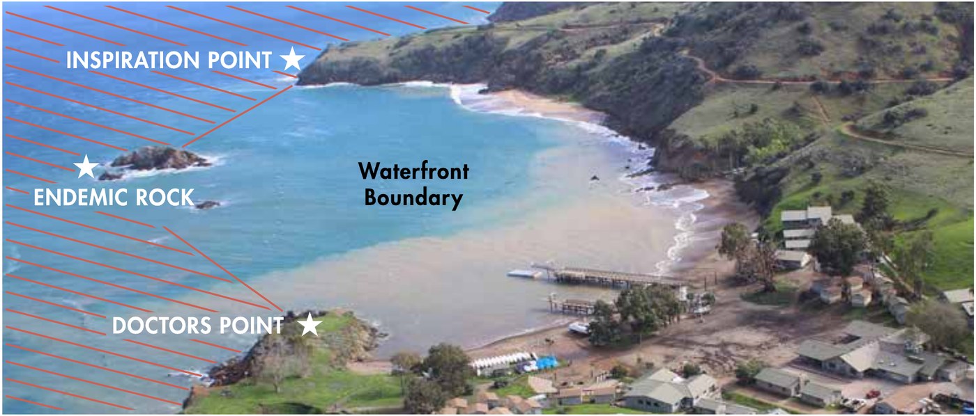
We camp at Emerald Bay, on Catalina’s west end, and swim out from there. Two Harbors is the nearest settlement, over the isthmus. Camp Emerald Bay’s own aerial photo below shows the bay we swim in and the boundary that marks it. For live tide, marine and temperature forecasts, see Weather.

Camp Emerald Bay's own annotated aerial photo of the swim area, marking Inspiration Point, Doctor's Point, Indian Rock, and the waterfront boundary
Camp Emerald Bay’s own aerial photo of the bay — the swim boundary runs Doctor’s Point to Indian Rock (their label: “Endemic Rock”) to Inspiration Point. As their guide puts it: if camp staff can see you, you’re within the boundary.

The bay from above

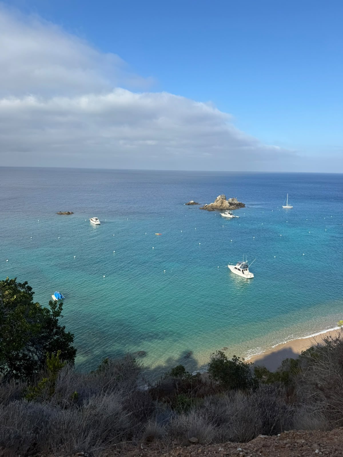
The same anchorage, a wider view.

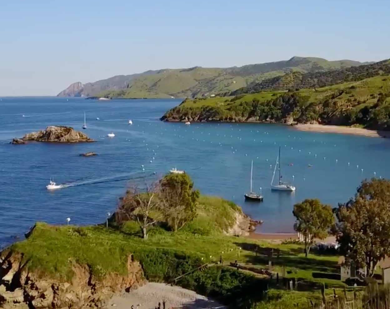
Aerial view of Emerald Bay's anchorage, sailboats moored off the beach, from Camp Emerald Bay's own Participant Guide
Also Camp Emerald Bay’s own photo, from the cover of their Participant Guide — the same cove as the boundary photo above, from a wider angle: the beach, the mooring field, and the hills that shelter it.

The routes

Two swims out from camp.

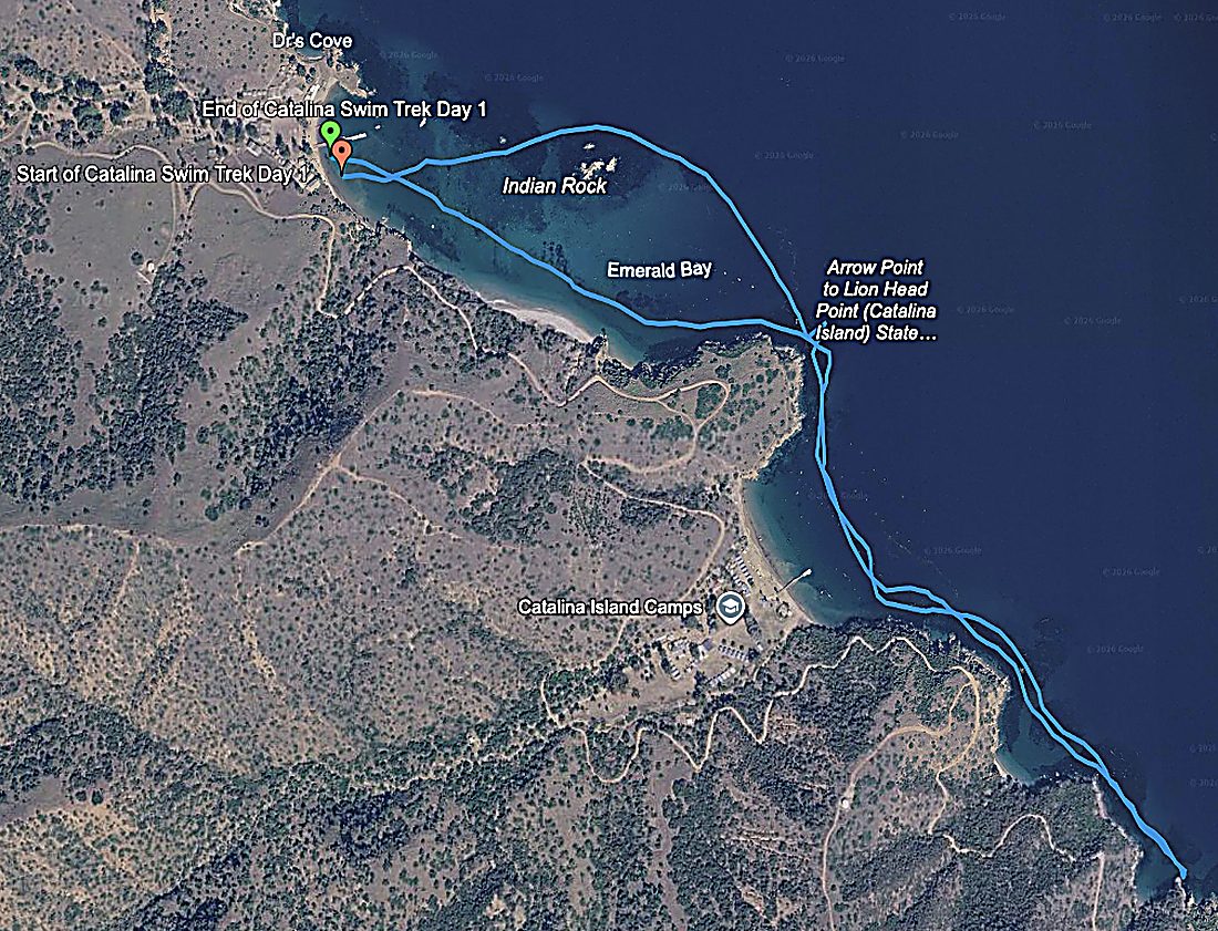
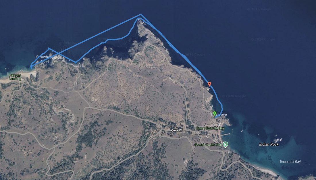
Two separate swims out from the Emerald Bay anchorage — Friday afternoon’s 2.79-mile “south bound” swim toward Howland Landing, and Saturday’s 2.65-mile “north bound” swim toward Strawberry Cove and Parsons Landing — the trip’s big group swim. Bill’s own recollection of Saturday’s swim is closer to 1.7 miles each way, and his Garmin recorded 2:28:06 door to door including a break at Parsons Landing. There was also a shorter swim Sunday morning that nobody tracked, so it isn’t mapped here. Olivia originally shared the Friday and Saturday routes as Strava routes, but every Strava export of Saturday’s swim — including two fresh, independent re-exports — carried the exact same GPS trackpoints as Friday’s. The real northbound line only ever existed in Google My Maps; exporting it from there directly is what got the second line below.
Day 1 — south bound

Google My Maps screenshot of the Day 1 southbound swim route: a blue line from Camp Emerald Bay south through Emerald Bay past Indian Rock toward Howland Landing, green start pin and red end pin, real terrain and place labels visible

Day 2 — north bound

Google My Maps screenshot of the Day 2 northbound swim route: a blue line from Dr's Cove near Camp Emerald Bay northwest along the coast past Strawberry Cove to Parsons Landing, green start pin and red end pin, real terrain and place labels visible